The lake
Lake Lanier and the Chestatee River arm
Chestatee sits on the Chestatee River arm of Lake Lanier, a Corps of Engineers reservoir. Normal summer pool is one elevation, winter pool is a foot lower, and flood storage rises well above both. The Corps sets shoreline rules and permits docks only in certain areas. Check the lake yourself on the USGS gauge, and never rely on a listing for a boundary.
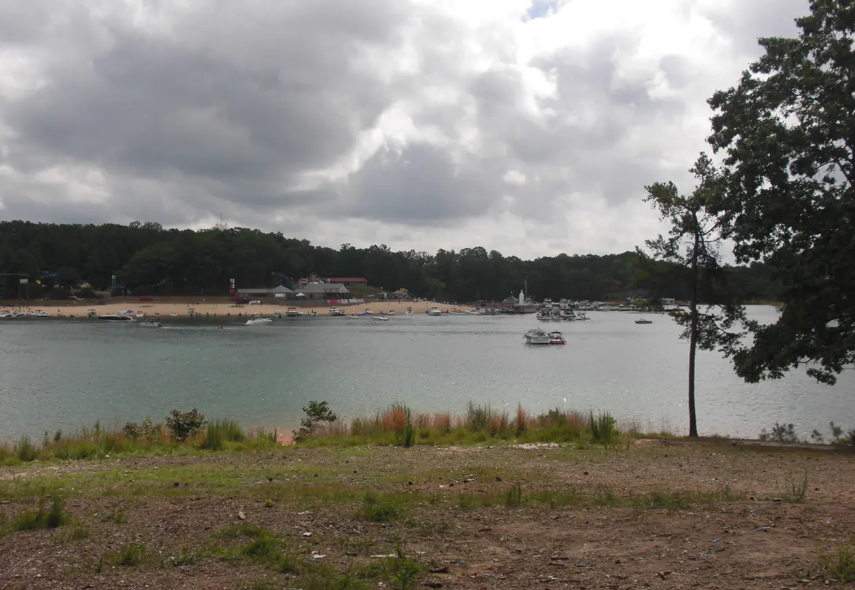
The lake and its arm
Lake Lanier is a Corps project in the Chattahoochee and Chestatee river basins; Buford Dam finished impoundment in 1957.src From Buford Dam the reservoir extends about 44 miles up the Chattahoochee River and about 19 miles up the Chestatee River.src The Corps recreation page says Lake Lanier has over 690 miles of shoreline and over 100 small islands.src
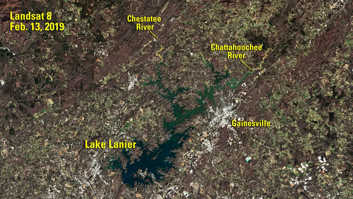
Pool levels, in plain terms
Lake Lanier's normal (full summer) pool is elevation 1,071 feet above mean sea level, covering about 39,038 acres.src Under the Corps water control manuals, full winter pool is 1,070 feet.src Storage between elevations 1,071 and 1,085 feet is reserved for flood control.src At maximum flood storage the lake reaches elevation 1,085 feet, covering about 47,182 acres.src
The seasonal switch dates are not stated here: we did not verify them from a primary source. Check the Corps for the current schedule.
What the Corps does with the shoreline
Corps shoreline is zoned Limited Development, Public Recreation, Protected and Prohibited Access.src Private and community docks may be permitted only in Limited Development Areas, which are 47% of the shoreline.src Corps policy bars septic tanks and drain fields on public property below 1,085 feet.src
Whether a particular Chestatee lot touches Corps land, where the Corps line sits on it, or whether the 1,085src-foot line is its boundary, is a survey question. We do not answer it for any address.
Where to watch the lake
USGS gauge 02334400 reports the Lake Sidney Lanier water-surface elevation near Buford, GA.src USGS gauge 02333500 is on the Chestatee River near Dahlonega, GA (upstream of the lake).src The Corps lake office handles the rest: The Corps Lake Lanier Project Management Office is at 1050 Buford Dam Rd, Buford, GA 30518, phone 770-945-9531.src
Why a community on the arm reads the lake differently
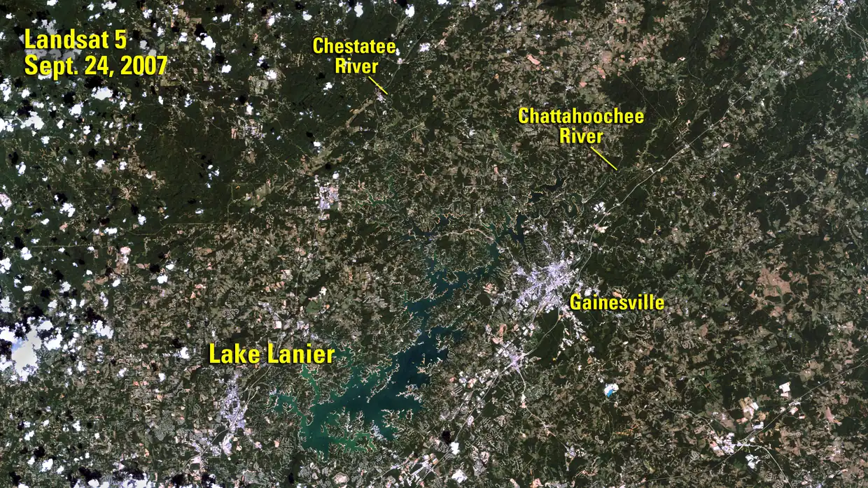
The two Landsat satellite images on this page show the same lake in a low year and a high year, so you can see how much of the shoreline moves with the water. Shoreline that is dry in one year is under the lake in another, which is one more reason to leave boundaries to a survey.
What is Lake Lanier’s full summer pool?
Lake Lanier's normal (full summer) pool is elevation 1,071 feet above mean sea level, covering about 39,038 acres.
Source: USACE Mobile District, Final EIS (Nov 2003) Section 3.0. Checked 2026-10-20.
What is full winter pool?
Under the Corps water control manuals, full winter pool is 1,070 feet.
Source: USACE Mobile District press release, Feb 15, 2018. Checked 2026-10-20.
How high does the lake go in a flood?
At maximum flood storage the lake reaches elevation 1,085 feet, covering about 47,182 acres.
Source: USACE Mobile District, Final EIS (Nov 2003) Section 3.0. Checked 2026-10-20.
What is the flood-control zone?
Storage between elevations 1,071 and 1,085 feet is reserved for flood control.
Source: USACE Mobile District, Final EIS (Nov 2003) Section 3.0. Checked 2026-10-20.
How far up the Chestatee River does the lake reach?
From Buford Dam the reservoir extends about 44 miles up the Chattahoochee River and about 19 miles up the Chestatee River.
Source: USACE Mobile District, Final EIS (Nov 2003) Section 3.0. Checked 2026-10-20.
How much shoreline does Lake Lanier have?
The Corps recreation page says Lake Lanier has over 690 miles of shoreline and over 100 small islands.
Source: USACE Mobile District, Lake Sidney Lanier Recreation (Wayback snapshot 2026-05-10). Checked 2026-10-20.
How is the shoreline zoned?
Corps shoreline is zoned Limited Development, Public Recreation, Protected and Prohibited Access.
Source: USACE Mobile District, Final EIS (Nov 2003) Section 3.0. Checked 2026-10-20.
Where can docks be permitted?
Private and community docks may be permitted only in Limited Development Areas, which are 47% of the shoreline.
Source: USACE Mobile District, Final EIS (Nov 2003) Appendix E. Checked 2026-10-20.
Can there be septic below the flood line?
Corps policy bars septic tanks and drain fields on public property below 1,085 feet.
Source: USACE Mobile District, Final EIS (Nov 2003) Section 3.0. Checked 2026-10-20.
Where can I check the lake level?
USGS gauge 02334400 reports the Lake Sidney Lanier water-surface elevation near Buford, GA.
Source: USGS Water Data for the Nation, Lake Sidney Lanier Near Buford, GA. Checked 2026-10-20.
Who operates Lake Lanier?
The Corps Lake Lanier Project Management Office is at 1050 Buford Dam Rd, Buford, GA 30518, phone 770-945-9531.
Source: USACE Mobile District, Recreation Passes (Wayback snapshot 2026-04-10). Checked 2026-10-20.
Last checked 2026-10-20. Written by the Chestatee on Lake Lanier Editorial Team. Rules, dates and contacts change: confirm with the office we link before you rely on anything here.